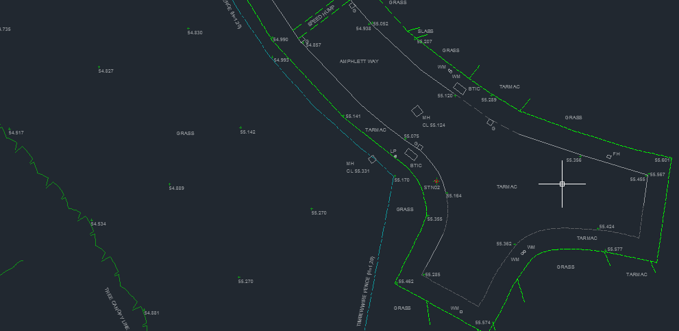
Working with a wide variety of clients ranging from architects to engineers, we tailor our surveys to your needs. We have worked on projects as small as a residential garden, up to entire retail complexes, recreational pathways to major highways. We are currently using some of the latest Leica Total Station technology, combined with Global Positioning Systems (GPS) to produce an accurate representation of your project.
Volume Calculations
With a 30 tonne truck costing extortionate amounts per day it’s important to accurately calculate the volumes of your project, whether it’s soil, coal, hardcore or waste, it will be expensive to get it wrong. Depending on the site conditions we will use a Global Positioning System (GPS) and/or a Leica Total Station to survey the area of interest. After the correct data has been collated we will produce a 3D ground model with contours and calculate the volume. If they are needed, we can then produce cross sections through the data. This information can be sent in a variety of formats such as DWG, PDF, KTF and Geo office.
Setting Out
By utilising some of the latest technologies, Advanced Surveys can set out anything from boreholes and trial pits to buildings. Depending on the nature of the site and the level of accuracy required our experienced staff will decide which equipment is most appropriate to use.
Boundary Surveys
Knowing exactly where the boundary to a property is can be extremely important. Whether it’s setting out a new boundary or having a dispute with your neighbour, we can offer a simple solution. Working with Land Registry records and survey data recorded on site we will prepare any technical information that will help solve the dispute. If necessary, we can provide a court with the appropriate advice and information needed to make a judgement.